Community Fire Plan
The following information isdetailed so that you may understand the reason behind our Community Fire Plan and why we need you to update the information we have on our database. Please read it carefully as we would like you to update your details through the link at the end of the page.
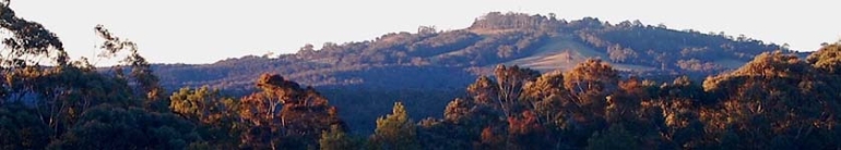
The Bilpin area regularly experiences major fires, in recent years 1994, 1997, 2001 /2002 & November 2002. These fires usually impact on the area for between 7 to 10 days. Fires of this magnitude involve fire fighters from elsewhere and have included fire fighters from as far away as Victoria , South Australia , West Australia & most recently from Tasmania.
The experiences of the fires of the 80's and 90's have made us aware of the need for more information about the area that we cover. In 1990 in cooperation with the National Parks & Wildlife Service the Brigade started a program of mapping, physically walking around all the properties. This was a major task that took about 30 days over some 4 years, at the end of which NPWS staff, Nic Gellie, Lyndsay Holme & Stuart James compiled and produced 3, 1:25000 maps.
• Assets at Risk (structures, farms, agro forestry etc). Included was a rating for each house to in particular identifies those at extreme risk or that could provide an abnormal risk to fire fighters to defend.
• Fire Advantages. This included all fire trails; rainforest, water supplies, helipads and plans for fuel reduced zones behind residential properties close to bush.
• Fire History. This includes all wild fires, hazard reduction burns or small fires updated on an annual basis.
The mapping task was completed about the time of the 1994 fires and along with recent aerial photography that the Brigade had purchased proved to be invaluable tools during those fires.
The fires of 1994 created recognition of the need to “manage the community” as well as the fires during these emergencies. The “Ash Wednesday” fires of 1982 demonstrated that most civilians are injured or killed because of poor decisions based on little or no information. To this end the key element we have recognised was the ability to have the property location and all the telephone numbers for each property. Work was started on a community database using Microsoft Access.
To manage all the information it was necessary to have the computer hardware and appropriate software. The Brigade with the support of a Community Group purchased the spatial database/ mapping programme, MapInfo and the computer hardware to use it. In simple terms Mapinfo displays information on digital maps in the form of symbols, i.e.a house symbol, when the symbol is clicked on; all or any part of the information that is stored in the database can be displayed. As we have progressed, with the project development the versatility of the software has given rise to the recognition that much other information necessary for our tasks can be displayed on the same maps.
Starting in late 1997, the project has progressed to now as follows
• Development team (6 people) investigates data bases structure and information requirements. Within the team we have key specialist skills in databases, MapInfo & mathematical problem solving. All of those involved with the development have as well significant fire fighting experience.
• Consulted widely within the Rural Fire Service to find out what else was happening
• Wrote standards for data collection and privacy agreement.
• Negotiates with Hawkesbury City Council to supply and to refresh every 3 months, land holder names, addresses, lot and Deposited plan number ( key link to maps)
• Piloted land holder survey with 50 properties and modified as a result of pilots
• Commenced a community education program about the project
• Commenced the community survey in 1999 completed in late 2001 with a 98 % voluntary response. The survey was done by mail out only.
• Data entry completed late 2001.
Landholder Database
The key to the whole system is the landholder data base. The information gathered can be used as the Access database or as fields for queries in MapInfo. In the development of the landholder database the team looked at collecting data that wouldn't age rapidly, would provide communication links back to each property owner, would quantify risk to the major assets, along with other data to assist fire fighting efforts. One of the difficulties foreseen was the transfer of properties. The system is designed so that when a property changes hands, the new owner is identified by the data refresh from the council, these data refreshes can be at any time period that is requested, and once the query process is established with the Council, data refresh is simple, with the data being emailed . The transferred properties generate a form for the Brigade to visit the new landholders and seek their cooperation and record any new telephone numbers or if the new residents had any special needs (aged, infirm, no transport, home dialysis etc). As well the old record is retained for a further 12 months. In operation the data base is password protected to 3 levels, is designed not to allow silent numbers to be printed out. Personnel trained to use it will be required to sign a privacy protection agreement. The data base contains many features that need to be seen to be appreciated. Hawkesbury City Council has recently agreed to provide us with their cadastral information which will overcome the problems from using Land Information Centre cadastral information which can be quite out of date. This throws up difficulties creating links with MapInfo.
In parallel with landholder survey the following work was commenced.
• Development of standards for and data collection methods for water assets, water to be assessed for vehicles, bouywalls (portable dams), and helicopters.
• Development of a data base which using simple tools allows for objective field assessments of dams, a rating being apportioned to the water source by the data base. Database has been piloted in 2 other brigades and we have started data collection.
• Acquisition of other spatial information from other (see attached list) sources
• Development of file structures and data relationships ( see attached list & diagram)
• Discussions with “Careflight” NSW, about the standards for development of a database of landing sites on or near major roads.
Privacy
The information provided by you is for the exclusive use of the Bilpin Rural Fire Brigade and is only used toi communicate with youand to help us plan for coming bushfires. It is not used for any other purpose and it is not handed to any third party unless it is required to by law. The use of the information is limited to those authorised by the Bilpin Rural Fire Brigade executive committee to do so.
Please go to our contact page (click here) and update your details whenever your circumstances change. If you are not sure that you have informed us of your changes then tell us again as we would rather get it right then not get it at all.